Arizona, New Mexico Ride
Arizona, New Mexico Ride

I left Eagle Rider motorcycle rentals at 9:15 am and
made my way in the the 202 East Freeway.
The last time I was on this freeway I got stuck
in road construction at 30 degrees Celsius. This time I had open roads
and made great timing on the ring road. Finally I found my exit of
East Brown road and headed straight for superstition mountain. After a
small rest stop to take in the view I headed up the
historic route 88, the Apache trail.


This highway has seen better
days I’m afraid. The road was a pattern of 20 mile an hour curves
which had me up on the handle bars riding to the conditions of the
pavement. A series of dips and dives brought me to
the one way lane bridges of Canyon lake, where I took in the impressive
views of a clear lake and jagged Rocky Mountains. I arrived at
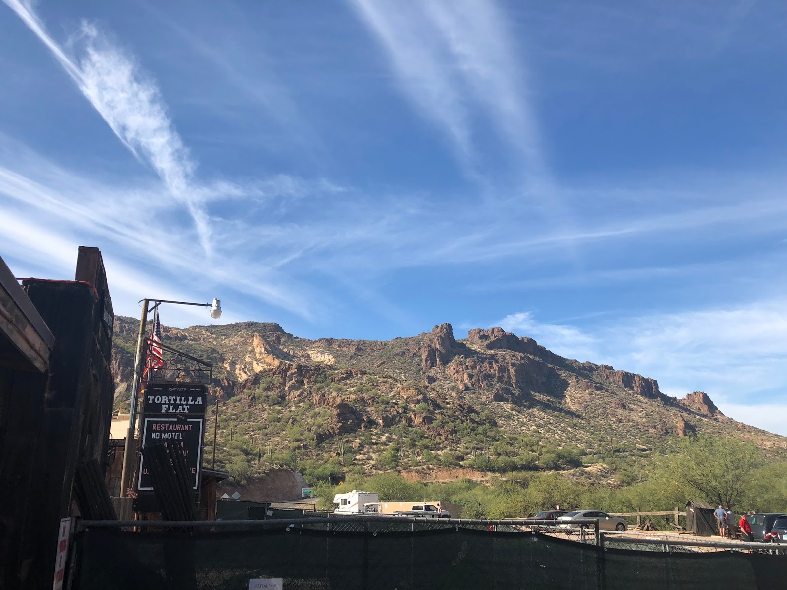
Tortilla flats and bought some sunscreen before back tracking back down
the Apache trail towards Apache junction.


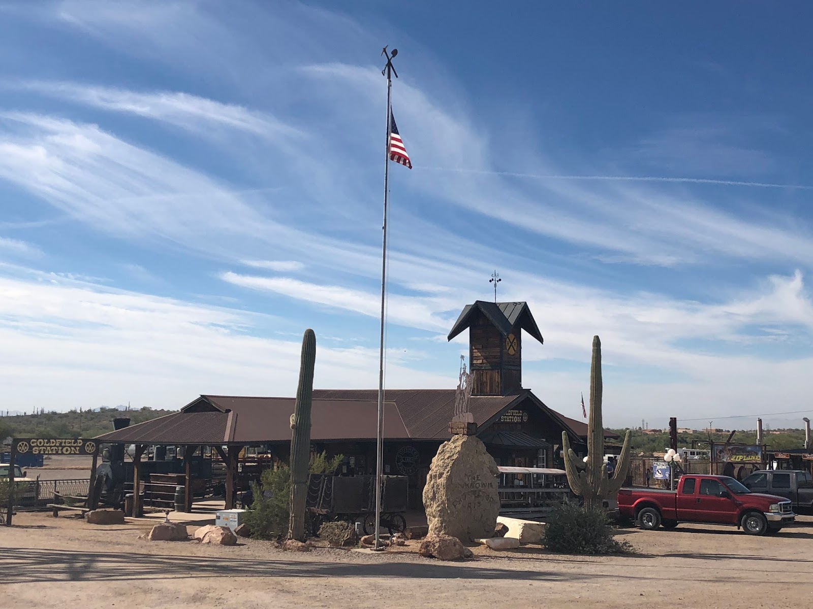
On my return ride down the Apache Trail I stopped in at Goldfield. A ghost town rich with history with its boom in the 1890's


Following Tomahawk Rd I headed south to link on to route 60. The
freeway eventually turned in to a two lane highway where it punched
through the Mountains via a tunnel near oak
flats. It is tunnels like this I wish I had the sounds of my Road
king instead of the rental. Just out side of Globe my travels took me
north on route 188 towards Roosevelt.


This highway was just what I
needed. The highway took off climbing 2000ft in
a short distance for a quick cool down before plummeting down the other
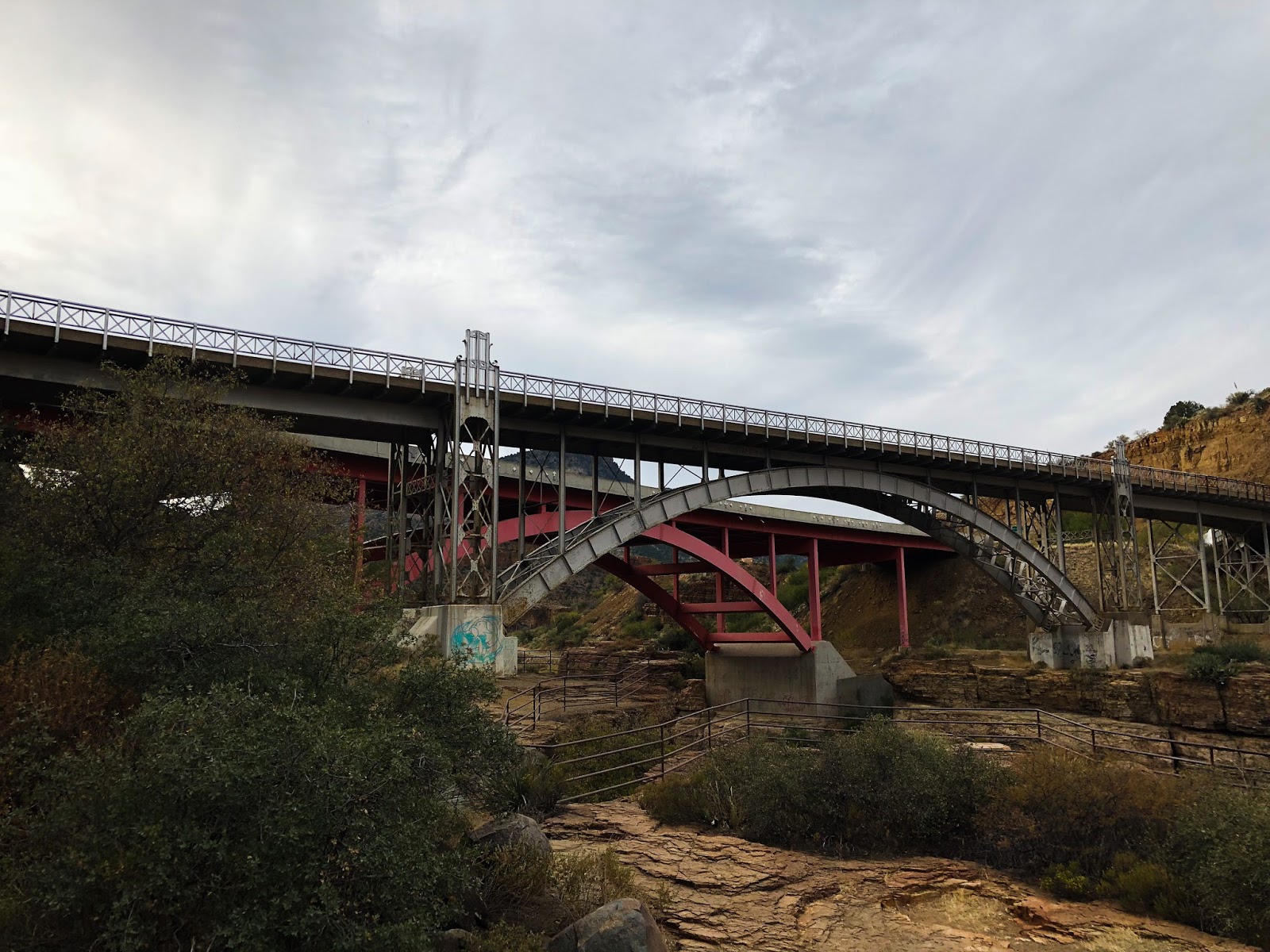
side towards Theodore Roosevelt Lake. Following the lake I came
across a cool bride at the Apache trail junction. Also at this junction
was Roosevelt Dam. A dam built between 1906 and
1911 on the salt River.


I
back tracked to Globe, hooking up with route 60 and headed North East.
The elevation changes made the cactus disappear bringing large shrubs
in its place. I climbed the the long
sweeping curves to high elevations over looking salt river canyon. Now
this canyon awoken me, the switch back corners had me working my bike
down the mountain side taking in impressive views of the jagged
landscape below.


At the bottom of the canyon there is a rest stop where I took advantage of a break before making my assault on the climb up the other side. Once I plateaued on the other side of the canyon the shrubs disappeared bringing forth tall pines which would line my path going forward.


I arrived in Show low Arizona at 4:00 pm and contemplated getting a room. Springerville was 85km farther down the road and I decided to push on before it got dark. I took the southern route 260 through Pine top a neat town lined with cabins. I almost had this highway to myself as I passed few cars. I arrived in Springerville Arizona just as it got dark checking in to Reed’s lodge, a biker friendly lodge.
I
left Springerville to a 3 degrees Celsius sunrise. I turned on to route
191 the Coronado Trail scenic byway. Formally known as route 666 the
devils highway. I am told the Federal
highway commission considers this to be the curviest road in the
nation. It was chilly starting off in the shade as I made my through
the swifting curves below the foothills of the white mountains. I made
my way with the the traffic to Alpine Arizona
where the highway branches off to the south west towards the pine
trees.


The highway at 9,200 feet started to wind through the forest as
it worked its way out to the plateaus where I would find peace and
solitude for the next 3 hours. The elevation rose and fell of 800
feet as I carved through the corners of shade then
light. I came across a view point called blue vista overlook. This
advantage point really gave me an appreciation of the valley I was about
to ride.


After Taking in the sights I got back on the bike and started my
descent. The road tightend up to a series of 25
mile per hour twisties as I chose my lines and dropped some gears.
The more the curves came at me the bigger m my smile became.
I would not recommend this highway to someone who is less
experienced with their turns. You have to really know our machine as
the highway is unforgiven with narrow shoulders, no guard rails and
steep embankments. And to add to this excitement is
the wildlife. I met 5 deer on various blind corners as well as I seen
two Javelina’s an Arizona Wild Pig like creature.


Just when I thought the highway could not get any better I
came across a sign that said no vehicles over 40 feet in length beyond
this point. The 25 mile per hour corner signs switched to just
maintain 25 miles per hour for the next 6 miles.
A roller coaster of switch back cures had my heart in my throat as my
bike commanded great respect as I worked the gears and throttle.
As I approached a section of 10miles per hour I knew this was
the section I was waiting for. I turned my music up of a fitting song
called hot rod Lincoln by commander Cody as I dove in to the corners.
My shifts went from second to first repeatedly
over this stretch rarely achieving third. Next song , Whoa, Black
Betty Bam-ba-lam. I kept throwing my 950 lb machine though the curves
recovering my lines just to lean back in to another one.


I exited the curves for a straight strech across a meadow on
one of the plateaus. This gave me an opportunity to put the bike in
cruise control for the next two miles and stretch out. At the far end
of the field the highway started is next series
of drop in elevations as the highway turned in to more or the jagged
rocky terrain I am accustomed to in Arizona. I came across one view
point where you can see the next 8 miles of switch backs ahead of you,
very impressive sights.


Upon reaching the bottom the highway split a huge copper mine
in Morenci. I am told they move similar amount of material as the mine I
work for. I followed the highway to Clifton Arizona for fuel.


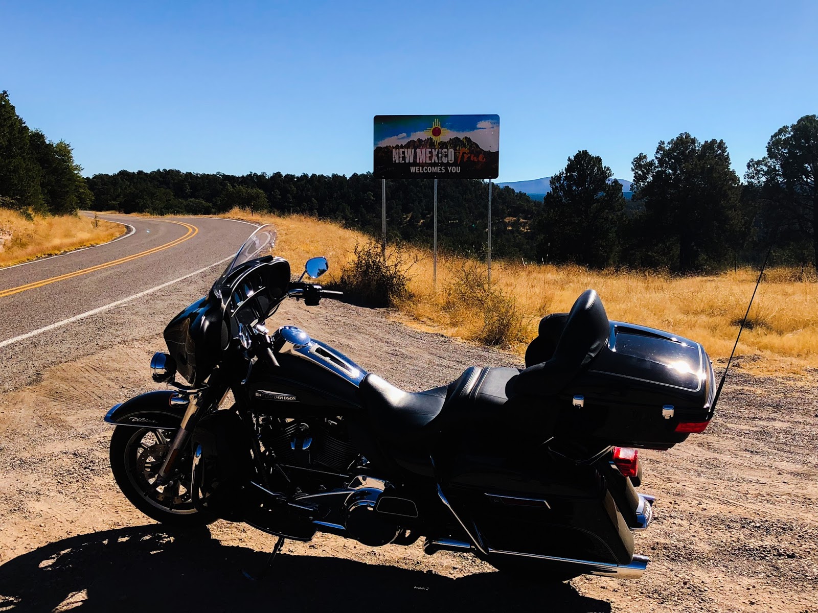
Upon Reaching Three way Arizona I took the 78 highway back in to the mountains and across the great divide in to New Mexico. I hooked on to the 180 and made my way to Silver City New Mexico. This highway was what I expected with rolling hills of meadow ranges. One neat point was experience the yellow fall leaves over again.


I took highway 90 leaving Silver City past Tyrone mines
where the dispatch system was created. Following 90 I hooked up to the
I 10 interstate to make some time up heading towards Tombstone. I got
off the freeway at Benson and took the highway 80
south. I made it to Tombstone just before the shops were about to
close and took in the sights. A good friend rode
out to meet me there from Tucson.


We left Tombstone and
rode north on and and then west on 82 on a sunset ride where we arrived
in Sonoita and had dinner at a great place called the Steak out. The
food was amazing cooked over an open flame. After a great dinner filled with conversation of rides past and
catching up we rode north on 83 to a outskirt community of Tucson called
Vail where my friend and his wife put me up for the night.
We rode out to Kitt peak. A 4000 feet winding climb up the
Mountain side to a summit filled with observatories and telescopes.
They even had one that was buried in the mountain used to look at the
sun. I am told there is many countries that have
their own telescopes on the mountain side.


After taking in the views we rode back down the mountain side
hitting the corners one more time. The ears were popping with the
quick descent back down to Ajo highway. We followed the highway back
west to the South Kinney road which turned in
to gates pass road, a cactus filled park ride with the old Tucson movie
studio at the one corner of it. If you ever have time and enjoy
western movies, many classics were filmed here.
Exiting gates pass road we made our way on speedway blvd where
we stopped at the intersection of the I 10 before parting ways. I made my way north east on the
77. At first I doubted my decisions. Red light
after red light I saw my eta slip farther and farther behind. Once I
got past Catalina the highway opened up and the traffic flowed freely.
I turned north on the 79 and made way through the desert
to Florence. A prison community that they say has roughly 9,500 people
incarcerated there. Massive is an understatement. If the series of
prison yards does not get your attention maybe
it’s the home land security compound just to the north of it.
Linking back on to highway 60 I followed the freeway west
to Phoenix and returned the bike rental to Eagle rider. The staff
was excellent and even gave me a shuttle back to the hotel I booked.
The most interesting part of my conversation
with them is that my eagle rider membership which already had great
benefits is about to become a whole lot better. They signed a deal with
Harley Davidson to take over their rental program. I already knew this
but what I did not know by the end of next
year my ride credits that I accumulate ever month with my fees will go
from 20 locations to over 200. If you want to know more pm me and I
can get you a referral code. I see many more amazing rides in my
future.

Comments
Post a Comment